Электронная почта: otrar_muzey@mail.ru
Мекен –жайы Түркістан облысы,
Отырар ауданы, Шәуілдір ауылы,
Жібек жолы даңғылы №1
Баспасөз хатшысы
8 705 897 6881, 8 708 407 2845
yrzia@mail.ru
A UNIQUE OBJECT FOR CULTURAL TOURISM IS APPEARED IN OTRAR
On December 1, the official opening of the Sapar visit center of the Oterar State Archaeological Reserve in the Oterar district of the Turkestan region took place within the framework of the article of Elbasy of state "Looking to the future: Modernization of public consciousness" with the support of the Ministry of Culture and Sports of the Republic of Kazakhstan on the occasion of the birthday of Elbas.
FullINFORMATION PRESS TOUR OF REPRESENTATIVES TOURISM ASIAN COUNTRIES
On November 4, 2019, the international tourism forum Turkistan: “One Way - One History” was held. Representatives of the Asian tourism industry attended the event and organized an information press tour of the Otrar region.
FullWITNESS CENTURIES - MAGIC WORLD MUSEUM
The event “Museum night” was held on the theme "ҒАСЫРЛАР КУӘСІ - МУЗЕЙДІҢ ҒАЖАЙЫП ӘЛЕМІ" in Otrar State Archaeological preserve-museum of the Ministry of Culture and Sports of the Republic of Kazakhstan within the framework of the republican action "Parade of Museums ".
Full“ҚАМАЛЫ БЕКЕМ, ХАЛҚЫ ҚАЙСАР ОТЫРАР” (dedicated to the 800th anniversary)
A planned movable exhibition was organized on the theme: “ҚАМАЛЫ БЕКЕМ, ХАЛҚЫ ҚАЙСАР ОТЫРАР” dedicated to the 800th anniversary of the defense of Otrar under the article
FullMUSEUM FUND WAS REPLENISHED BY THE VALUABLE ETHNOGRAPHIC ITEMS
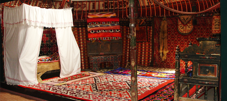
An ethnographic expedition aiming to explore cultural heritage was organized on the theme "Қолөнер ұлттық құндылығымыз" under the article “Seven facets of the Great Steppe” of the first president of RK by the stuff of RSE “Otrar state archaeological preserve museum” of the Ministry of Culture and Sport of RK.
FullVISIT CENTRE OF «ОТЫРАР ҚАЛАЖҰРТЫ» IS COMPLETED
The first “Tourist Center” in our country was launched in November 2018 in the area of the Otrar. The planned construction was completed in August 2019. Currently, museum employees are preparing for the exposition hall.
FullA NEW APPOINTMENT IN THE OTRAR PRESERVE MUSEUM
By order No. 144 of the Ministry of Culture and Sports of the Republic of Kazakhstan, Kozeybaev Sapar Aliyaskarovich was appointed acting director of the RSE “Otrar State Archaeological preserve museum”. Deputy Director of the Department of Culture and Art of the Ministry of Culture and Sports of the RK Argynbek Maksat Argynbekovich introduced the new head of the museum.
Full“SPIRITUAL REVIVAL - THE CONCEPT OF CREATING A SUCCESSFUL SOCIETY.
Today, on July 22, a round table on the theme “Spiritual Revival - the Concept of Creating a Successful Society” was held in the Department of Ethnography, Literature and Cultural Events of the Otrar State Archaeological Museum-Reserve.
Full“FIRST PRESIDENT AND SAGA OF INDEPENDENCE”
On August 5, 2019 in the Otrar State Archaeological Museum of the Ministry of Culture and Sports of the Republic of Kazakhstan, an exhibition was opened on the theme “THE FIRST PRESIDENT AND SAGA OF INDEPENDENCE” dedicated to the Day of the Capital.
FullKAMALY BEKEM HALKI KAYSAR – OTYRAR
Within the article of the State Nursultan Nazarbaev of the Republic of Kazakhstan, “Seven Facets of the Great Steppe” in East Kazakhstan, the moveable exhibition of Otrar state archaeological preserve-museum was organized on the theme: «KAMALY BEKEM HALKI KAYSAR – OTYRAR».
FullTHE MINISTER OF CULTURE AND SPORTS OF KAZAKHSTAN ARYSTANBEK MUHAMEDIULY VISITED THE VISIT-CENTER " OTYRAR KAlAZHURTY»
In order to promote the cultural heritage of the Otrar oasis in the country and abroad and creating a tourist center in accordance with modern requirements in the sphere of tourism, in the Otrar district of the mountain resort is built tourist center "Otyrar calgary".
FullTV series will be filmed about the great ruler of the Kazakh Khanate Kasym Khan
On June 15, 2019 Arystanbek Muhameduly, Minister of Culture and Sports of the Republic of Kazakhstan, was on a working visit in Otrar region. During the visit Minister Arystanbek Muhamediuly met with the Director Designer of Turkey Metin Guney and introduced the medieval Otrar. Under the leadership of Metin Guney, it was decided that the film studio "Kazakhfilm" would be present Kasim Khan as a person who fought for the prosperity and strengthening of the Kazakh Khanate. It is known that the shooting will start in the city of Otrar.
FullTHE FESTIVAL OF MUSEUMS "THE GREAT STEPPE'S HERITAGE"
On June 11, 2019, the International Museum Festival "Legacy of the Great Steppe" was organized by the Zhezkazgan Historical Archaeological Museum in Zhezkazgan, the Department of Culture, Archives and Documentation of the Karaganda region and the Zhezkazgan Historical Archaeological Museum.
FullHISTORICAL HERITAGE AND SPIRITUAL WEALTH
On June 11, 2019 the international Kazakh-Turkish University named after Kozha Akhmed Yassawi in Turkestan and the Otrar State Archaeological Reserve Museum organized a tour of young historians and historical sites in the Otrar region on the theme " HISTORICAL HERITAGE AND SPIRITUAL WEALTH ".
FullKAMALY BEKEM HALKI KAYSAR – OTYRAR
On June 10, 2019, the International Kazakh-Turkish University named after Kozha Akhmed Yassawi in Turkestan and the Otrar State Archaeological Reserve Museum held a seminar on "KAMALY BEKEM HALKI KAYSAR - OTYRAR". The head of the historical cognitive club "Orda" Sizdikov declared about the goal of the seminar, dedicated to the 800th anniversary of the Otrar defense, and declared it open.
FullA charity event "From heart to heart"
Today, the Otrar state archaeological Museum for people with disabilities held a charity event "From heart to heart". In 1992, the United Nations declared the second Sunday in October the International day of persons with disabilities. People with disabilities need special care and kindness.
FullState symbols of our pride
Today, the Otrar State Archaeological preserve museum celebrated the Day of State Symbols of the Republic of Kazakhstan. The event was began with the performance of the National Anthem of the Republic of Kazakhstan by the audience. At the opening ceremony, the museum director Ersin Tazhibaev congratulated the museum staff on this significant day and noted: “It is the duty of every citizen to declare the country's independence as the whole and to preserve the spirit, national traditions, heroism and wisdom of our people, desire for the future, symbols and state symbols”.
FullACTS OF KINDNESS FOR KIDS
June 1 it took place a festive event on the occasion of the International Children's Day on the theme “ACTS OF KINDNESS FOR KIDS”, which was organized by the Ministry of Culture and Sports of the RK, Otrar state archaeological preserve-museum in corporation with Akimat of the Otrar region. This festive event was attended by the head of the region, representatives of intelligentsia, schoolchildren and kids.
FullThe construction of the tourist center «ОТЫРАР ҚАЛАЖҰРТЫ» will be completed soon
It is well known that a tourist center “Otyrar Kalazkurty” is being built near the ancient settlement of Otrar to popularize the cultural heritage of the Otrar Oasr in our country and abroad, as well as to create a tourist center meeting the modern requirements of the tourism industry.
FullTOURISM CENTER
ҚР Мәдениет және спорт министрлігі, Отырар мемлекеттік археологиялық қорық-музейінің ұйымдастыруымен Елбасымыз Н.Ә.Назарбаевтың «Ұлы даланың жеті қыры» бағдарламасы аясында «Отырар – туризм орталығы» тақырыбында пресс-тур ұйымдастырылды.
FullCUSTODIAN OF NATIONAL HERITAGE
On April 9, employees of the department of Ethnography, literature, cultural and social events of the Otrar State Archaeological Preserve-museum, together with the Temir school stuff and employees of the Timur Rural House of Culture organized a scientific and practical seminar on the theme “ Custodian of National Heritage”, dedicated to the 90th anniversary of the founder of the Otrar museum and historian Asatai Alimov.
FullMercy - the spiritual creed of the peoples of Kazakhstan
In March 1, it was held a round table on the theme “Mercy - the spiritual creed of the peoples of Kazakhstan.” in Otrar state archaeological preserve-museum. The purpose of the event is to explain the students the meaning of Thanksgiving Day and strengthen friendship among different nationalities.
FullProblems of preservation and restoration of cultural heritage
November 29, 2018 in the framework of the program article of the President N. Nazarbayev "Look into the future: modernization of public consciousness" was organized by the Republican scientific and practical seminar Otrar state archaeological Museum-reserve on "Problems of preservation and restoration of cultural heritage."
FullTHE EXHIBITION “The Cultural Heritage of the Sacred Otrar” OPENED IN KYZYLORDA
November 26, 2018 in the framework of the implementation of the program of the President N.Nazarbayev “Course towards the future:” and in connection with the 20th anniversary of the city of Astana in the Kyzylorda region In the Art Gallery named after Aitbaeva opened a thematic and traveling exhibition of the Otrar State Archaeological Museum of the Otrar District of the Turkestan Region on the theme “The Cultural Heritage of the Sacred Otrar”.
FullMinister of Culture and Sports of the Republic of Kazakhstan Arystanbek Mukhamediuly visited Otrar.
On September 28, a working trip of the Minister of Culture and Sports of the Republic of Kazakhstan Arystanbek Muhamediyuly to the town of Otrar was held. He took part in the laying of a capsule with a message to future generations on the site of the visit of the Visitor Center of Otrar.
FullResidents and guests of Mangistau region can visit exhibitions of sacral Otrar
On July 8, 2018 it was officially opened thematic and moveable exhibition by Otrar state archaeological preservation museum on the theme “Cultural heritages of the sacred Otrar” within the framework of the program article of our President “Course towards the future: modernization of Kazakhstan’s identity” in Aktau. It was held the opening ceremony of the exhibition, which was organized to propagate the history of the sacred Otrar in the modern world.
FullOPENING CEREMONY OF THE EXHIBITION “HOLY HERITAGES OF THE ANCIENT OTRAR” WAS HELD IN ATYRAU.
In June 25, 2018 within the framework of President N.Nazarbayev’s program article “Course towards the future: modernization of Kazakhstan’s identity and the 20th anniversary of the capital of Astana, it was organized the thematic movable exhibition “Holy heritages of the ancient Otrar” in Atyrau oblast historical and regional museum by Otrar state archaeological preservation museum.
FullThe sacred heritage of the sacred Otrar
Today in Astana, at the National Center for Manuscripts and Rare Books, with the support of the Ministry of Culture and Sports of the Republic of Kazakhstan, the grand opening of the exhibition took place within the framework of the program article of President N. Nazarbayev...
FullModernized Museum
In March 1, 2018, a new modernized exposition hall of the Otrar State Archaeological Museum-Reserve was opened.
FullToday, on March 1, the official opening ceremony of the renovated exposition of Otrar state archaeological preservation museum will take place.
Representatives of the Ministry of Culture and Sports of the Republic of Kazakhstan ...
FullANNOUNCEMENT!
29th 2017 year within the framework of realization of the program "Рухани жаңғыру" the employee of the
FullHISTORICAL VALUE OF NATIONAL LIBERATION REVOLT AT THE HEAD WITH KENESARY
29th 2017 year within the framework of realization of the program "Рухани жаңғыру" the employee of the
Full“PROBLEMS OF RESTORATION AND CONSERVATION OF THE CULTURAL HERITAGE”
In November 10, 2017 within the framework of President N.Nazarbayev’s program article “Course towards the future: modernization of Kazakhstan’s
FullKitchenware from Otrar oasis
Within the framework of the program article of the Head of our state N.A.Nazarbayev ‘Perspectives: modernization of social consciousness’ the staffs
FullThe transition to the Latin alphabet is the new peak of the Kazakh language
On October 19, a round table was organized in Otrar State Archaeological preservation museum on the theme "Transition
FullAhynnyn sozi-omirdin ornegi
Today, as part of program article of Perzident N. A. Nazarbayev "Bolashakka Badar: Ruhani zhangyru" research division
FullExhibition “Civilizabion Farab - Otrar” in Kyzylzhar
On 19 September at the Museum complex "Residence of Abylay Khan" was the opening of the exhibition
FullIn Turkestan arrived the famous conductor Zubin Meta
An outstanding musician of the world famous La Scala Zubin Mehta and the Minister of culture and sports
FullSpecial project "Geography of the holy places of Kazakhstan" is in Otrar region
On August 19, 2017 Youth Cognitive Expedition under the special project "Geography of the holy places of Kazakhstan" was in the historical
FullOTRAR EXHIBITIONS IN KOSTANAY
Today it took place an opening ceremony of the thematic exhibition “ Farab – Otrar civilization” within the framework of EXPO – 2017 organized
FullAncient books of Otrar are in Turkestan
Within the framework of the international exhibition EXPO-2017 held in Astana it was organized an exhibition of books on the theme: “Ancient books are the guarantee of spiritual rebirth” in the library hall of the mausoleum of Kodja Akhmed Yasaui in Turkestan by Otrar state archaeological preservation-museum.
FullThe Arystanbab library is the returned treasure
The condition of after October Revolution is known for all. Religious leaders, kozhas, mullahs, imams were victims of persecution and repression because of the soviet-atheistic policy.
FullKOK TUDYN ZHELBIREGENI
Оn June 4 the Otrar archeological State Museum-reserve organized a round table devoted to the day of national symbols on the theme "Memlekettik rәmіzder- eldіgіmіz bin birligimiz".
FullActoin Zhetim korsen zhebei zhur
June 1 - World Children's Day. This international holiday has been celebrated since 1950. In connection with the celebration of this significant event, the employees of Otrar state archaeological preservation museum organized a charity event "Жетімкөрсеңжебейжүр" in Shymkent
FullSupporting young talents -2
On May 7, 2017 RSE “Otrar state archaeological preservation museum” together with Otrar Regional Sport School organized a toguzkumalak tournament dedicated to the hero of the Soviet Union TemirbekIbragimov to support
FullTraditionai fair of Otrar masters
On May 24th in entertainment center of "Keremet" on May 18 by "The international day of the museum" the third year the Otrar state archaeological reserve museum will organize
FullHistorical heritage is precious treasure!
April 21 the staffs of the “Archaeology and protection for the historical monuments” scientific research department of Otrar state archaeological preservation museum organized
FullRelics of the ancient Otrar in Kokshe
May 17, 2017 in Akmola oblast historical and regional museum it was held an opening ceremony ofOtrarstate archaeological preservation museum
FullAncient exhibits are in Astana
In the Military History Museum of the Military-patriotic Center of the Armed Forces of RK it was solemnly openedthe exhibition of the Otrar state
Full“Saraishyk: the history of the great city”.
April 3, 2017 The Ministry of Culture and Sport and the Administration of Atyrau oblast will hold an International conference
FullMeeting of Turkic people in Turkestan.
This year Turkestan administration is a coordinator of the 35th session of the permanent council "Turksoy". The title "The spiritual capital of the Turkic world" is officially
FullMERCY - SPIRITUAL CREDO OF THE PEOPLE OF KAZAKHSTAN
A new holiday was established by the decree of the head of the state on March 1- the Day of Gratitude in the Republic of Kazakhstan.
FullArcheology
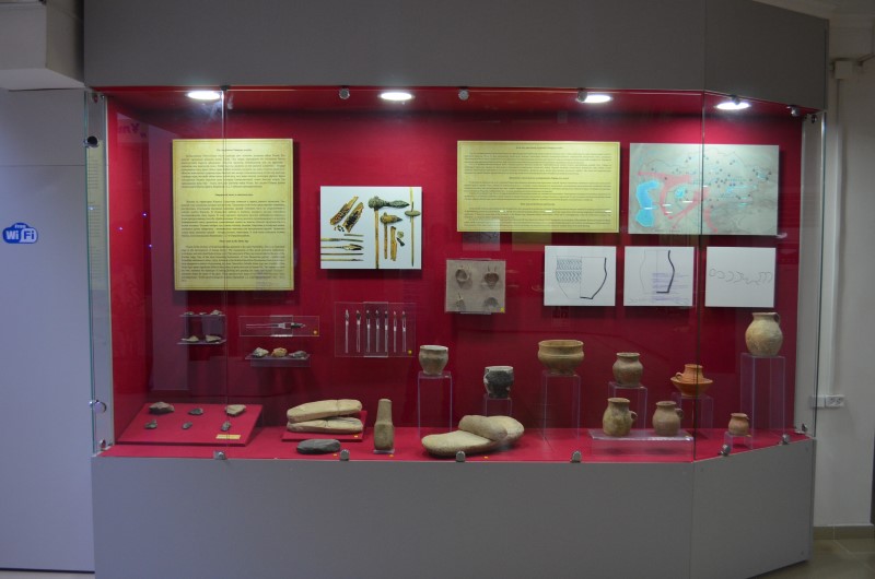
Otrar oasis in the Stone Age
People in the territory of South Kazakhstan appeared in the early Paleolithic. This is an important stage in the development of human history. The monuments of this epoch presented settlements, workshops, and individual finds of stone tools. The main parts of them are concentrated in the area of the Karatau ridge. One of the most interesting monuments of Late Mousterian period – multilayered Paleolithic settlement is Aksu – Arys. In the era of the Middle Paleolithic (Mousterian) there is a shift to a more progressive method of processing the stone. Mesolithic (Middle Stone Age) and Neolithic (New Stone Age) spans significant shifts in many areas of production and in human life. The human invented the bow, mastered the technique of cutting, drilling and grinding the stone, and learned microlits – miniature plates for liners of the guns. There appeared new types of the stone tools like axes, hoes, grinding stones. To this epoch belongs the location Zhanashilik 1, 2, 3 and the site Mayatas (10th – 7th cc BC).
Otrar oasis in the Bronze and Iron Age
In the middle of the second millennium BC Kazakh tribes have mastered the production of bronze. Bronze become the main raw material for making tools and weapons. At the beginning of second millennium BC the comprehensive pastoral and agricultural economy is formed in the steppe tribes. The rapid development of cattle breeding and metallurgy of these two main areas of the economy of the Bronze Age, demanded mainly male labour, which led to a strengthening of the role of the men in society and ultimately - to change his father's maternal clan (patriarchy). At the end of the second and at the beginning first millennium BC the climate has changed and it became dry on the territory of Kazakhstan. Reduced the area of natural water, which were limited and in some areas, and sharply reduced the spread of the farming in the floodplains of large and small rivers. In these circumstances, for the majority of the population of the steppe regions of Kazakhstan the only direction economy was transition to nomadic and semi-nomadic forms of livestock farming.
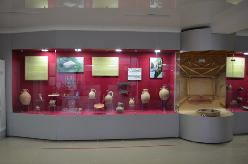
Otrar Oasis during the reign of the Kangju state
In the last centuries BC and the 1st centuries of AD the regions of Middle Syrdaria were part of the Kangju possession. There is a sufficient reason to believe that the nomadic Kangju were the direct descendants of Saka – Massaget tribes from the previous period. At that time revealed materials indicated the real stay of Huns in the Syrdaria valley. Exactly on the periphery of the Otrar oasis, on the left bank from the modern bed of Syrdaria, in the region of the old bed of Syrdaria revealed the settlements Shanshar-Asarshyk and Akkorgan. Noteworthy the plane of the settlement has a clear geometric shape with the traces of clearly readable towers in micro relief. Lifting ceramics from the settlement concerns to the 1st century BC.
Otrar oasis in the middle of the 6th and beginning of the 8th c in the period of Old Turkic khaganate.
In 552 a mighty Turkic khaganate was originated in Central Asia (in the Altai mountain area). Over time, Tarband possession which consisted of the following historical regions - Isfījāb, Otrar, Shavgar, Taraz, Shash were included under the rule of the Turkic khaganate. In the Old Turkic written resources Otrar was known as Kangu Tarban and presented the military and political centre of this historical area. Governors of the Kagan – a supreme ruler of the Turkic state ruled Otrar. Otrar minted its own coin, one side of which was a picture of the local governor and his wife, in some the image of the lion, on the reverse side a sigh in the shape of a fork. Since 640 the rulers of the Tarban possession wore the title Tudun that indicate the origin of the Turkic khagan. According to the written sources the governors of this historical are of Syrdaria were Shabolo Shekhu (Ishbara yabgu), Gan tutun (Ton tudun, 658y), Mokhedu tutun (Bakhadur tudun, 713 – 740 y), Inai tutun Kiuele (Inai tudun Kiuliug, 741 y).
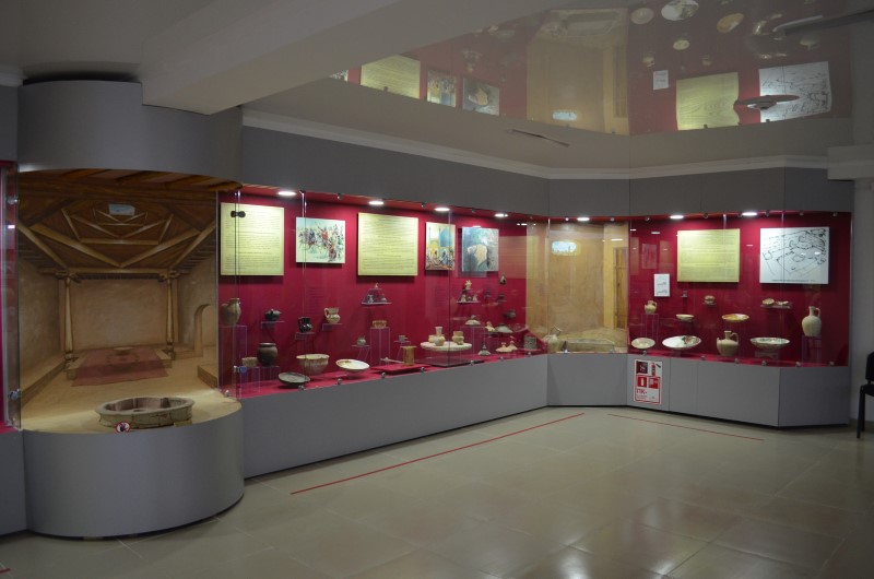
Occupation of the sovereignty of Tarband-Otrar by Muslim troops
The 8th century made changes in the history of Otrar. Islam - one of the major religions was appeared in Otrar. According to al-Balazuri, a commander of arabs Kutaiba reaches Isfījāb (The city Isfījāb located on the place of Sayram) during the campaign to Shash in 712 – 713 y. During the Muslim march through Syrdaria in 737 – 739 y Sutkent and Zerniuk were captured under the rule of Abd ar-Rakhim. In Sutkent area the army crossed to the right bank and getting to the centre of the oasis they captured Otrar. According to the “Nasab-name” Karaaspan (the area in the middle current of Arys), Sayram, Sauran were captured later.
Otrar is a native land of the great scientist Abu Nasr al-Farabi
According to the work of Ibn Khallikan “Deaths of Eminent Men and History of the Sons of the Epoch” (13th c): Abū Naṣr Muḥammad b. Muḥammad al-Ṭarḵānī, Awzalaḡ al Farabi was a Turk, well-known thinker and made contributions to the fields of logic, music and other sciences. He is the greatest philosopher of Muslims and no one has reached his level in his sciences. The head thinker Abu ali Ibn Sina mastered and could not understand until he read al-Farabi's commentary on the work and imitated his style. Al – Farabi means belonging to Farab, the modern Otrar. This city lies beyond as - Shash and near the city of Balasaghun. It is one of the capital cities of the Turkish nation. He (Abu Nasr) was from Turkic origin, was born and grew up in his country . . . when coming to Baghdad al-Farabi knew Turkish and some other languages, but not yet enough Arabic to be able to pursue his philosophical studies in that language.
Otrar Oasis during the reign of the Karakhanids and Samanids
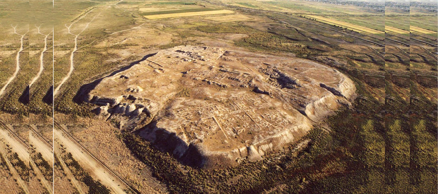
Otrar was captured by the Samanids in the 10th century. Gavel coins in Barab (Farab) of 922-923 y in the name of Samanid Emir Nasr II ibn Ahmad was a demonstration emphasizing the occurrence of this area of the Samanid state. In coin it was given the name of the vassal ruler Ali. In the end of the 10th century Samanid State is fall down, their possessions moved to Karakhanids which conquered the whole Central Asia. Otrar was one of the destinies of Karakhanid state. It was given the lists of the Karakhanid rulers of Otrar in the work of Safi ad-Din Oryn Koilaky "Nasab-nama": “Kılıç Arslan khan came to Otrar and ruled 40 years. His son Ismail khan. His son Ilias khan. His son Akhmad khan. His son Sanzhar khan. His son Khasan khan. His son Muhammad khan, his title was Bilge khan. His son Dadbek khan. His son Abd al-Khalik khan. All of them ruled in Otrar. A sultan of Urgench Muhammed sultan came and killed Bilge khan”. According to the numismatist B.D.Kotchneva, the last ruler of Otrar was Shams ad-Dunia va d-Din (he is Tadj ad-Din) Kutluk Bilga-khagan Khasan ibn Abd al-Khalik. He came to power in 590-600 y from the hijri year and was killed in 607 from hijri year (1210-1211, modern chronology). Otrar was blossomed during the reign of Karakhanids state. Otrar became a large urban center with a developed structure, including shakhristan with a citadel with a total area of 16 hectares and rabad with an area of about 200 hectares.
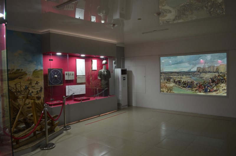
Otrar in the epoch of Mongol invasion
The siege of the city of Otrar in 1219-1220 by Mongol army was described in the works of contemporaries. Revival of the city begins in the middle of the 13th century. Otrar minted gold, copper, silver dirhams. Periphery is built of mansions, apartment blocks, workshops of different profile, baths. Being a large economic center, Otrar remained the city during the 13th – 14th centuries for the right of ownership that was a constant struggle between Jochids and Chagataids. In the first decades of the 14th century Juchids owned the city. "Anonymous of Iskander" reports about Erzene Khan that "he was a very clever king, righteous, perfect, and God-fearing. Most of the madrassas, khanaka, mosques and other charities that are in Otrar, Sauran, Jand and Barchkend, were built by him". In addition, products of imported origin give us an indication about the international relations of Otrar. It became a major trading center from Europe to China.on the Silk Road.
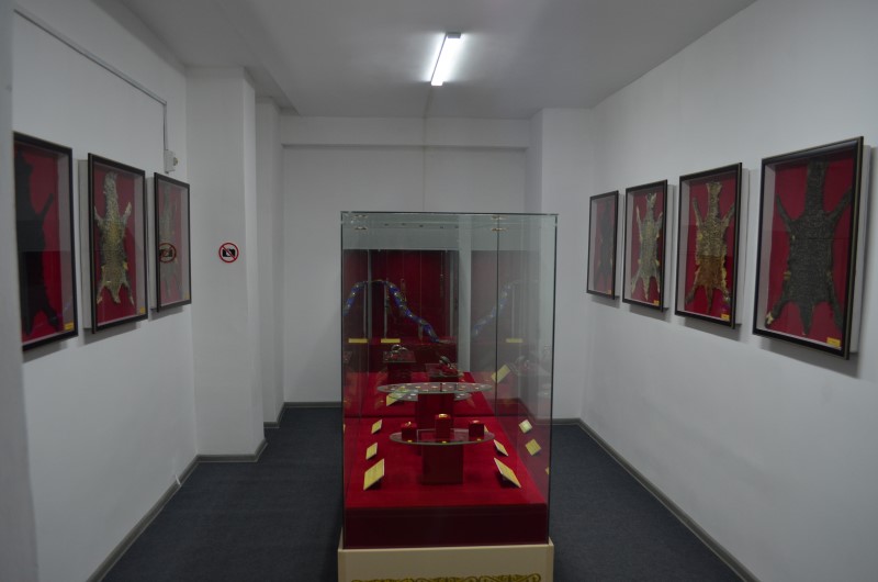
Алтын залы
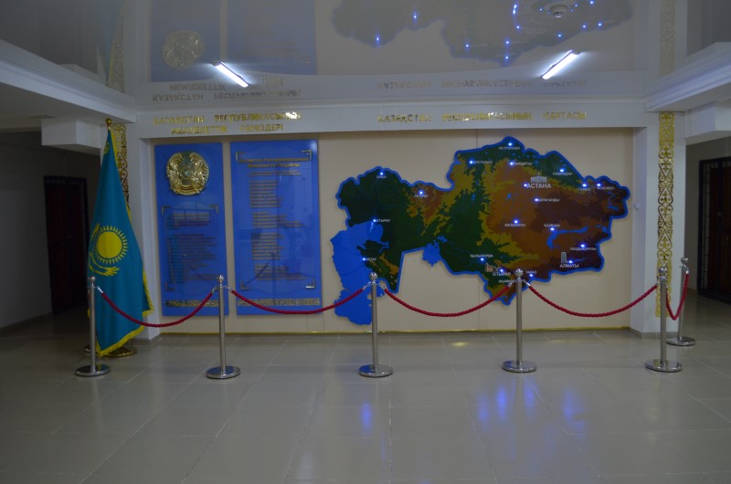
Қазақстан Республикасының мемлекеттік рәміздері
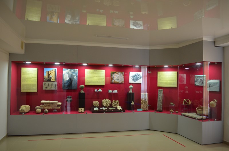
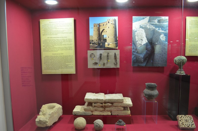
The south-western gate of Otrar
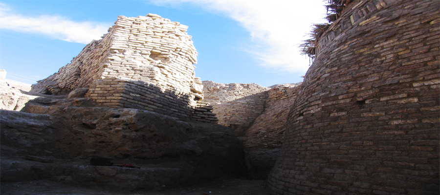
Guardhouses, columns of the bridge, remaining of the city wall, southern and northern minarets were obtained during the excavations in the archaeological site of the south-western part of the gate. The gate, which was originally built in the 13th century, was renewed and strengthened by each ruler. The location of the original gate is uncertain and a guardhouse of the 14th century was erected on the site of the moat where previously excavated. One part of the outer minarets stretches the gate and the other part stretches the guardhouses. As well as the rooms of the guardhouse of connect with the fortress of shakhristan. The foundation of the minaret and the gate is laid of the burnt bricks of 4,1 m, height is 27,5х27,5х6 cm and the upper part is laid of the mad bricks. After finishing its public service this area became a burial place between 14th – 15th cc. Later, in the 15th – 16th cc there were erected block of flats and workshops. These gates were connected with the main street. 12 m straight ravine is clearly shown in the topography of the monument. Small branches of the streets are spread from the gate and stretch with the walls. In turn smaller streets In turn, smaller streets and cliffs divide the city's territory into different blocks.
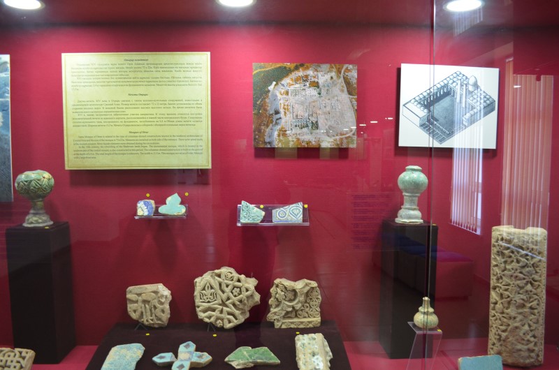
Mosques of Otrar
Juma Mosque of Otrar is related to the type of columnar-domed constructions known in the medieval architecture of Central Asia and the size of the mosque is 72x22м. Minarets are installed on both side of the entrance. There were spiral stairs in the western minaret. More façade elements were obtained during the excavations. In the 16th century, the rebuilding of the Shahrisan lands began. The monumental mosque, which is located in the southern part of the central mound, is also constructed in this period. The columnar-domed construction is built on the ground at the depth of 0.4 m. The total length of the mosque is unknown. The width is 15.5 m. This mosque served as a Friday Mosque with a large front area.
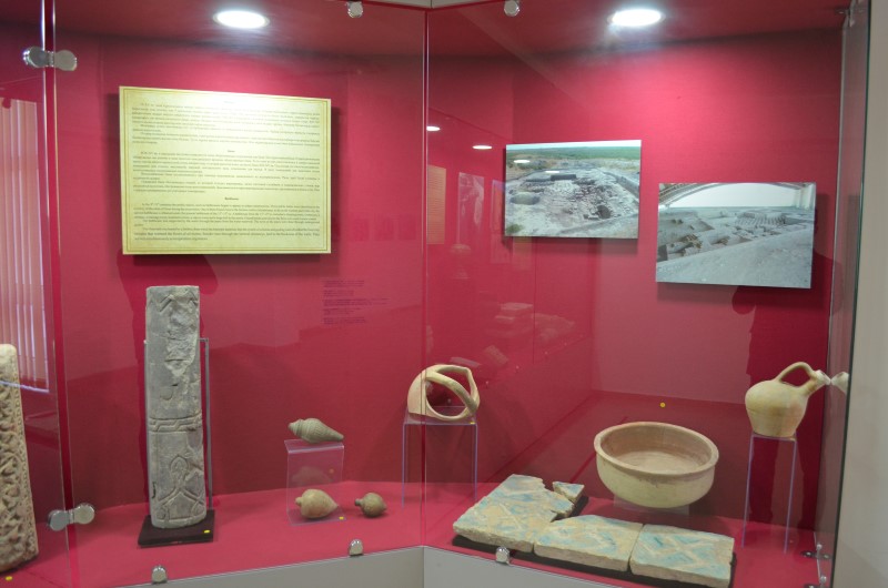
Bathhouse
In the 9th-15th centuries the public places, such as bathhouses began to appear in urban constructions. Three public baths were identified on the territory of the rabat of Otrar during the excavation. One of them found close to the fortress walls of shakhristan, to the north-western part of the city, the second bathhouse is obtained under the present bathhouse of the 13th-15th cc. A bathhouse from the 13th-15th cc included a dressing room, a restroom, a mosque, a massage room, treatment rooms, a vapour room and a large hall in the centre. Glazed bricks and tiles for the floor were used in some rooms. The bathhouse was supported by the water through the pipes from the water reservoir. The rows of the pipes were done through underground gallery. The Otrar bath was heated by a firebox, from which the heat pipe departed, then the system of columns and guiding walls divided the heat into streams that warmed the floors of all rooms. Smoke rises through the vertical chimneys, laid in the thickness of the walls. They served simultaneously as temperature regulators.
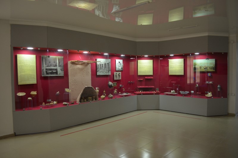
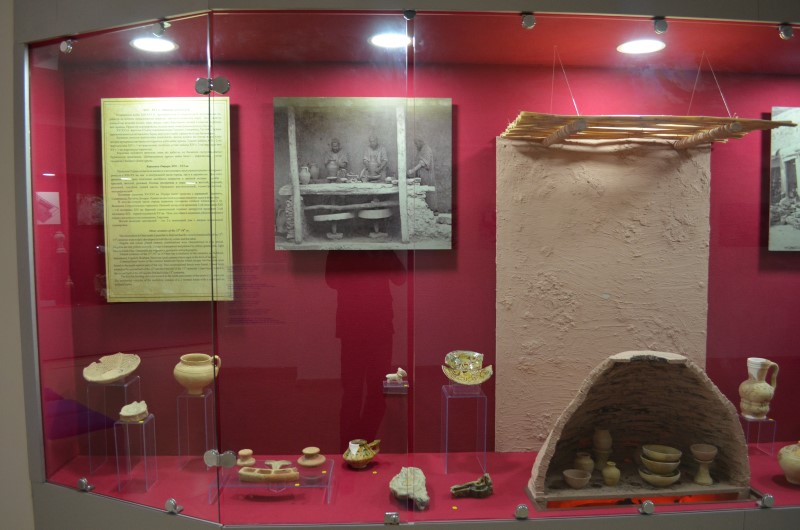
Otrar ceramics of the 13th-16th cc.
The excavation in Otrar made it possible to find out that the ceramic handicrafts of the 13th-15th centuries were widely developed in both the city center and the rabat. Engobe and colour glazed ceramic combinations were characterized in this period. Engobes are red, yellow and pink. Colour is transparent and painted in yellow, green, pink, light blue and dark blue. Ornaments are vegetative, geometric and ephigraphic. Glazed ceramics of the 15th-16th cc of Otrar has a similarity to the ceramics of Tashkent, Samarkand, Urgench, Bukhara. However, local ceramics have signs in the form of tamgas. Constructional layers of the ceramic handicraft blocks which occupy two hectares were found in the south-eastern part of the city. Two constructional levels were found. Lower layer related to the second half of the 13th and the first half of the 15th centuries. Upper layer related to the second half of the 14th and the first half of the 15th centuries. The kiln for burning ceramics located in the north-east corner of the room is 2 – storeyed. The residential complex of the workshop consists of a 2 roomed house with a courtyard an enfilade layout.
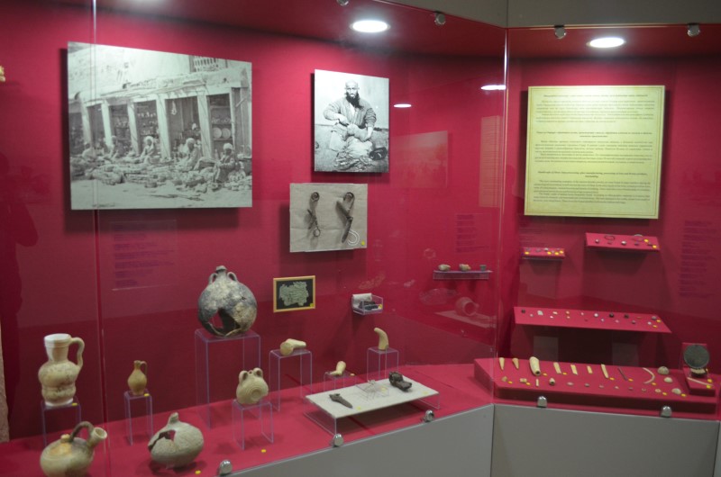
Handicrafts of Otrar: bone processing, glass manufacturing, processing of iron and bronze products, shoemaking.
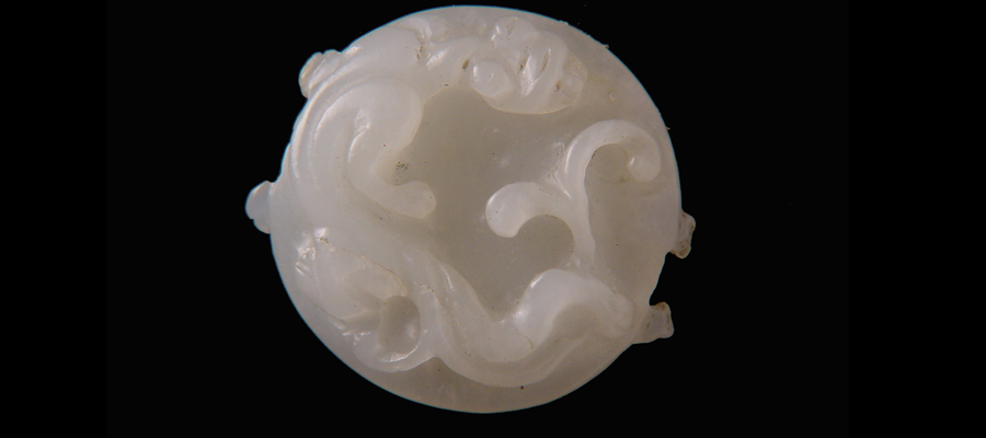
The most outstanding examples of the ancient Kazakh jewelry art were found in large numbers during the archaeological excavations in well-known the town of Otrar. In the early layers of the town women jewelries were some of round plaques, various bracelets and details of clothing. There were also a lot of beads made of cornelian, glass and paste and as always performed at a high technical level. The blanks made of animal horns frequently found. According to ethnographic materials it is known that many items for domestic use were made out of animal horns. The tube attached to the cradle, an awl were made of the horse, cow, sheep bones. There were also found spindles, knife knobs, buttons and rings.
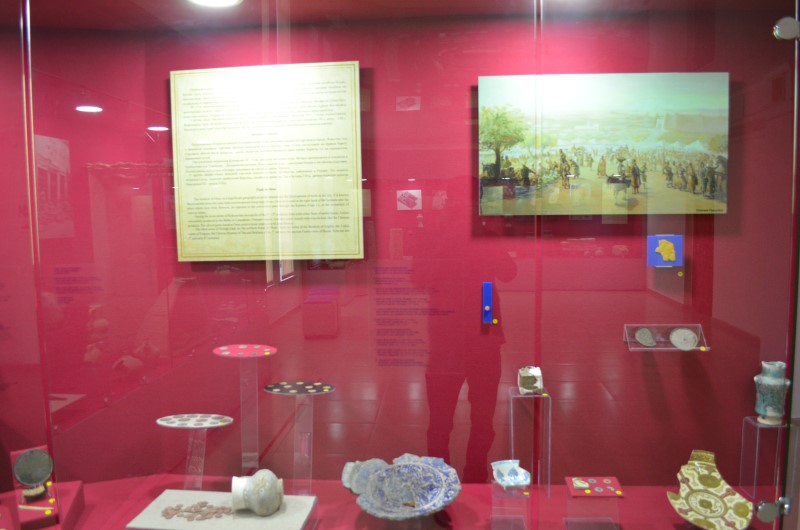
Trade in Otrar
The location of Otrar on a significant geographical point determined the development of trade in the city. It is known that in ancient times the main trade arteries passed along large rivers. Otrar is located on the right bank of the Syrdaria near the place where Arys river flows-in, its opposite to the convenient pass through the Karatau ridge, i.e. at the crossroads of caravan routes. During the excavations of Kokmardan necropolis of the 3rd – 5th centuries there were some finds of amber beads. Amber was mainly produced in the Baltic or Carpathian - Dnieper region. And also some vessels with tripods look like the Chinese products. The carved gems found in Otrar point to trade relations with Iran (Persia). The other areas of foreign trade are the artifacts found in Otrar. These are coins of the Ikhshids of Sogdia, the Turkic rulers of Fergana, the Chinese dynasty of Tan and Bukhara of the 7th century, the ancient Turkic coins of Shash from the late 7th and early 8th centuries.
Agriculture and irrigation
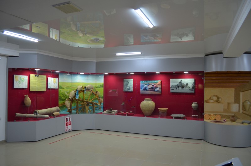
At the beginning of the middle Ages there was a large farm zone around Otrar and a number of partner communities. Channels have been drawn from the rivers for wheat, millet, rice and barley fields. Archeological and topographical study of the remains of irrigation structures with the use of aerial photographs shows that during the early iron period on the banks of the Syrdarya and Arys, liman irrigation system (in the mid-1st millennium BC - I-VI centuries AD) was widely spread. VII-IX centuries, during the period of origin and development of the early medieval states and cities, are characterized by a gradual transition from the liman forms to the self-flowing flood irrigation. The remains of millet, raw cotton, and wheat were found in the 7th – 8th cc layers of Otrar city. The main sowing areas were Otrartobe, Kuyuktobe, Altyntobe, Kuyukmardan. It was found hundreds of farmstead in this area. At that time, water was brought to the surrounding area through the Tostagan, Durtobe, Kokmardan, Sangyl-Aryk, Kaugan-Aryk, Ak-Aryk, Altyn-aryk, Karakonshek, Temiraryk irrigation systems.
Otrar in the epoch of Kazakh Khanate
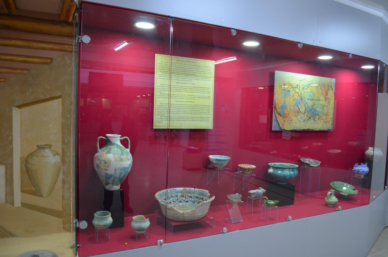
At the end of the 15th century it was started the battle for the cities of the middle current of Syrdaria, which occupied by the Timurid dynasty among the nomadic Uzbek, Kazakh, Mongolian rulers. In the middle of the 16th century the struggle between Kazakh and Uzbek khans continued. Kazakhs ruled Sozak and Syganak. Often, Otrar was under their control. At the end of the 17th century by using political situation in Central Asia Kazakh khan Tauekel occupied ualayats along Syrdaria and Tashkent. Otrar was owned by the Kazakh Khanate. Endless war, the city’s transfer from the hands of a ruler to another ruler led Otrar's material possessions to the loss of her spiritual wealth. Glazed ceramics of the 15th-16th cc: the background is blue, in a rare case green, transparently decorated bowl, plate and dagaras. The interior is painted with the same colour and two colours painted outer surface and it is very interesting. The jewelry consists of geometric (crosses, rhombs, cages) vegetal and epigraphic ornaments.
Inscriptions on ceramics
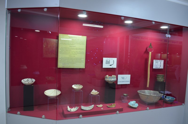
In the 11th-12th cc. Islam occupies dominant position in Southern Kazakhstan. From that time, Islamic institutions penetrate all spheres of public life, which is reflected in urban crafts. There were appeared plenty of items made of bronze, silver and ceramics, decorated with Arabic calligraphy in large numbers. In addition to some inscriptions are usually good wishes to the future owner of the product; there are excerpts from the Koran, poems. There are murals in a large number that imitate the Arabian ligature.


