
Электронная почта: otrar_muzey@mail.ru
Мекен –жайы Түркістан облысы,
Отырар ауданы, Шәуілдір ауылы,
Жібек жолы даңғылы №1
Баспасөз хатшысы
8 705 897 6881, 8 708 407 2845
yrzia@mail.ru
A UNIQUE OBJECT FOR CULTURAL TOURISM IS APPEARED IN OTRAR
On December 1, the official opening of the Sapar visit center of the Oterar State Archaeological Reserve in the Oterar district of the Turkestan region took place within the framework of the article of Elbasy of state "Looking to the future: Modernization of public consciousness" with the support of the Ministry of Culture and Sports of the Republic of Kazakhstan on the occasion of the birthday of Elbas.
FullINFORMATION PRESS TOUR OF REPRESENTATIVES TOURISM ASIAN COUNTRIES
On November 4, 2019, the international tourism forum Turkistan: “One Way - One History” was held. Representatives of the Asian tourism industry attended the event and organized an information press tour of the Otrar region.
FullWITNESS CENTURIES - MAGIC WORLD MUSEUM
The event “Museum night” was held on the theme "ҒАСЫРЛАР КУӘСІ - МУЗЕЙДІҢ ҒАЖАЙЫП ӘЛЕМІ" in Otrar State Archaeological preserve-museum of the Ministry of Culture and Sports of the Republic of Kazakhstan within the framework of the republican action "Parade of Museums ".
Full“ҚАМАЛЫ БЕКЕМ, ХАЛҚЫ ҚАЙСАР ОТЫРАР” (dedicated to the 800th anniversary)
A planned movable exhibition was organized on the theme: “ҚАМАЛЫ БЕКЕМ, ХАЛҚЫ ҚАЙСАР ОТЫРАР” dedicated to the 800th anniversary of the defense of Otrar under the article
FullMUSEUM FUND WAS REPLENISHED BY THE VALUABLE ETHNOGRAPHIC ITEMS
An ethnographic expedition aiming to explore cultural heritage was organized on the theme "Қолөнер ұлттық құндылығымыз" under the article “Seven facets of the Great Steppe” of the first president of RK by the stuff of RSE “Otrar state archaeological preserve museum” of the Ministry of Culture and Sport of RK.
FullVISIT CENTRE OF «ОТЫРАР ҚАЛАЖҰРТЫ» IS COMPLETED
The first “Tourist Center” in our country was launched in November 2018 in the area of the Otrar. The planned construction was completed in August 2019. Currently, museum employees are preparing for the exposition hall.
FullA NEW APPOINTMENT IN THE OTRAR PRESERVE MUSEUM
By order No. 144 of the Ministry of Culture and Sports of the Republic of Kazakhstan, Kozeybaev Sapar Aliyaskarovich was appointed acting director of the RSE “Otrar State Archaeological preserve museum”. Deputy Director of the Department of Culture and Art of the Ministry of Culture and Sports of the RK Argynbek Maksat Argynbekovich introduced the new head of the museum.
Full“SPIRITUAL REVIVAL - THE CONCEPT OF CREATING A SUCCESSFUL SOCIETY.
Today, on July 22, a round table on the theme “Spiritual Revival - the Concept of Creating a Successful Society” was held in the Department of Ethnography, Literature and Cultural Events of the Otrar State Archaeological Museum-Reserve.
Full“FIRST PRESIDENT AND SAGA OF INDEPENDENCE”
On August 5, 2019 in the Otrar State Archaeological Museum of the Ministry of Culture and Sports of the Republic of Kazakhstan, an exhibition was opened on the theme “THE FIRST PRESIDENT AND SAGA OF INDEPENDENCE” dedicated to the Day of the Capital.
FullKAMALY BEKEM HALKI KAYSAR – OTYRAR
Within the article of the State Nursultan Nazarbaev of the Republic of Kazakhstan, “Seven Facets of the Great Steppe” in East Kazakhstan, the moveable exhibition of Otrar state archaeological preserve-museum was organized on the theme: «KAMALY BEKEM HALKI KAYSAR – OTYRAR».
FullTHE MINISTER OF CULTURE AND SPORTS OF KAZAKHSTAN ARYSTANBEK MUHAMEDIULY VISITED THE VISIT-CENTER " OTYRAR KAlAZHURTY»
In order to promote the cultural heritage of the Otrar oasis in the country and abroad and creating a tourist center in accordance with modern requirements in the sphere of tourism, in the Otrar district of the mountain resort is built tourist center "Otyrar calgary".
FullTV series will be filmed about the great ruler of the Kazakh Khanate Kasym Khan
On June 15, 2019 Arystanbek Muhameduly, Minister of Culture and Sports of the Republic of Kazakhstan, was on a working visit in Otrar region. During the visit Minister Arystanbek Muhamediuly met with the Director Designer of Turkey Metin Guney and introduced the medieval Otrar. Under the leadership of Metin Guney, it was decided that the film studio "Kazakhfilm" would be present Kasim Khan as a person who fought for the prosperity and strengthening of the Kazakh Khanate. It is known that the shooting will start in the city of Otrar.
FullTHE FESTIVAL OF MUSEUMS "THE GREAT STEPPE'S HERITAGE"
On June 11, 2019, the International Museum Festival "Legacy of the Great Steppe" was organized by the Zhezkazgan Historical Archaeological Museum in Zhezkazgan, the Department of Culture, Archives and Documentation of the Karaganda region and the Zhezkazgan Historical Archaeological Museum.
FullHISTORICAL HERITAGE AND SPIRITUAL WEALTH
On June 11, 2019 the international Kazakh-Turkish University named after Kozha Akhmed Yassawi in Turkestan and the Otrar State Archaeological Reserve Museum organized a tour of young historians and historical sites in the Otrar region on the theme " HISTORICAL HERITAGE AND SPIRITUAL WEALTH ".
FullKAMALY BEKEM HALKI KAYSAR – OTYRAR
On June 10, 2019, the International Kazakh-Turkish University named after Kozha Akhmed Yassawi in Turkestan and the Otrar State Archaeological Reserve Museum held a seminar on "KAMALY BEKEM HALKI KAYSAR - OTYRAR". The head of the historical cognitive club "Orda" Sizdikov declared about the goal of the seminar, dedicated to the 800th anniversary of the Otrar defense, and declared it open.
FullA charity event "From heart to heart"
Today, the Otrar state archaeological Museum for people with disabilities held a charity event "From heart to heart". In 1992, the United Nations declared the second Sunday in October the International day of persons with disabilities. People with disabilities need special care and kindness.
FullState symbols of our pride
Today, the Otrar State Archaeological preserve museum celebrated the Day of State Symbols of the Republic of Kazakhstan. The event was began with the performance of the National Anthem of the Republic of Kazakhstan by the audience. At the opening ceremony, the museum director Ersin Tazhibaev congratulated the museum staff on this significant day and noted: “It is the duty of every citizen to declare the country's independence as the whole and to preserve the spirit, national traditions, heroism and wisdom of our people, desire for the future, symbols and state symbols”.
FullACTS OF KINDNESS FOR KIDS
June 1 it took place a festive event on the occasion of the International Children's Day on the theme “ACTS OF KINDNESS FOR KIDS”, which was organized by the Ministry of Culture and Sports of the RK, Otrar state archaeological preserve-museum in corporation with Akimat of the Otrar region. This festive event was attended by the head of the region, representatives of intelligentsia, schoolchildren and kids.
FullThe construction of the tourist center «ОТЫРАР ҚАЛАЖҰРТЫ» will be completed soon
It is well known that a tourist center “Otyrar Kalazkurty” is being built near the ancient settlement of Otrar to popularize the cultural heritage of the Otrar Oasr in our country and abroad, as well as to create a tourist center meeting the modern requirements of the tourism industry.
FullTOURISM CENTER
ҚР Мәдениет және спорт министрлігі, Отырар мемлекеттік археологиялық қорық-музейінің ұйымдастыруымен Елбасымыз Н.Ә.Назарбаевтың «Ұлы даланың жеті қыры» бағдарламасы аясында «Отырар – туризм орталығы» тақырыбында пресс-тур ұйымдастырылды.
FullCUSTODIAN OF NATIONAL HERITAGE
On April 9, employees of the department of Ethnography, literature, cultural and social events of the Otrar State Archaeological Preserve-museum, together with the Temir school stuff and employees of the Timur Rural House of Culture organized a scientific and practical seminar on the theme “ Custodian of National Heritage”, dedicated to the 90th anniversary of the founder of the Otrar museum and historian Asatai Alimov.
FullMercy - the spiritual creed of the peoples of Kazakhstan
In March 1, it was held a round table on the theme “Mercy - the spiritual creed of the peoples of Kazakhstan.” in Otrar state archaeological preserve-museum. The purpose of the event is to explain the students the meaning of Thanksgiving Day and strengthen friendship among different nationalities.
FullProblems of preservation and restoration of cultural heritage
November 29, 2018 in the framework of the program article of the President N. Nazarbayev "Look into the future: modernization of public consciousness" was organized by the Republican scientific and practical seminar Otrar state archaeological Museum-reserve on "Problems of preservation and restoration of cultural heritage."
FullTHE EXHIBITION “The Cultural Heritage of the Sacred Otrar” OPENED IN KYZYLORDA
November 26, 2018 in the framework of the implementation of the program of the President N.Nazarbayev “Course towards the future:” and in connection with the 20th anniversary of the city of Astana in the Kyzylorda region In the Art Gallery named after Aitbaeva opened a thematic and traveling exhibition of the Otrar State Archaeological Museum of the Otrar District of the Turkestan Region on the theme “The Cultural Heritage of the Sacred Otrar”.
FullMinister of Culture and Sports of the Republic of Kazakhstan Arystanbek Mukhamediuly visited Otrar.
On September 28, a working trip of the Minister of Culture and Sports of the Republic of Kazakhstan Arystanbek Muhamediyuly to the town of Otrar was held. He took part in the laying of a capsule with a message to future generations on the site of the visit of the Visitor Center of Otrar.
FullResidents and guests of Mangistau region can visit exhibitions of sacral Otrar
On July 8, 2018 it was officially opened thematic and moveable exhibition by Otrar state archaeological preservation museum on the theme “Cultural heritages of the sacred Otrar” within the framework of the program article of our President “Course towards the future: modernization of Kazakhstan’s identity” in Aktau. It was held the opening ceremony of the exhibition, which was organized to propagate the history of the sacred Otrar in the modern world.
FullOPENING CEREMONY OF THE EXHIBITION “HOLY HERITAGES OF THE ANCIENT OTRAR” WAS HELD IN ATYRAU.
In June 25, 2018 within the framework of President N.Nazarbayev’s program article “Course towards the future: modernization of Kazakhstan’s identity and the 20th anniversary of the capital of Astana, it was organized the thematic movable exhibition “Holy heritages of the ancient Otrar” in Atyrau oblast historical and regional museum by Otrar state archaeological preservation museum.
FullThe sacred heritage of the sacred Otrar
Today in Astana, at the National Center for Manuscripts and Rare Books, with the support of the Ministry of Culture and Sports of the Republic of Kazakhstan, the grand opening of the exhibition took place within the framework of the program article of President N. Nazarbayev...
FullModernized Museum
In March 1, 2018, a new modernized exposition hall of the Otrar State Archaeological Museum-Reserve was opened.
FullToday, on March 1, the official opening ceremony of the renovated exposition of Otrar state archaeological preservation museum will take place.
Representatives of the Ministry of Culture and Sports of the Republic of Kazakhstan ...
FullANNOUNCEMENT!
29th 2017 year within the framework of realization of the program "Рухани жаңғыру" the employee of the
FullHISTORICAL VALUE OF NATIONAL LIBERATION REVOLT AT THE HEAD WITH KENESARY
29th 2017 year within the framework of realization of the program "Рухани жаңғыру" the employee of the
Full“PROBLEMS OF RESTORATION AND CONSERVATION OF THE CULTURAL HERITAGE”
In November 10, 2017 within the framework of President N.Nazarbayev’s program article “Course towards the future: modernization of Kazakhstan’s
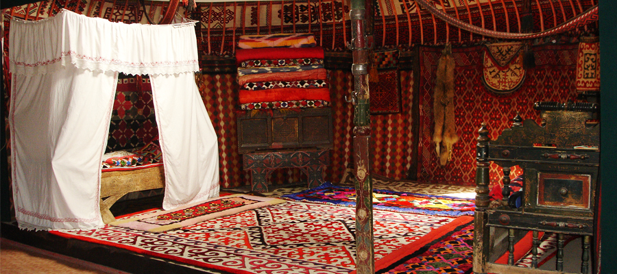
FullKitchenware from Otrar oasis
Within the framework of the program article of the Head of our state N.A.Nazarbayev ‘Perspectives: modernization of social consciousness’ the staffs
FullThe transition to the Latin alphabet is the new peak of the Kazakh language
On October 19, a round table was organized in Otrar State Archaeological preservation museum on the theme "Transition
FullAhynnyn sozi-omirdin ornegi
Today, as part of program article of Perzident N. A. Nazarbayev "Bolashakka Badar: Ruhani zhangyru" research division
FullExhibition “Civilizabion Farab - Otrar” in Kyzylzhar
On 19 September at the Museum complex "Residence of Abylay Khan" was the opening of the exhibition
FullIn Turkestan arrived the famous conductor Zubin Meta
An outstanding musician of the world famous La Scala Zubin Mehta and the Minister of culture and sports
FullSpecial project "Geography of the holy places of Kazakhstan" is in Otrar region
On August 19, 2017 Youth Cognitive Expedition under the special project "Geography of the holy places of Kazakhstan" was in the historical
FullOTRAR EXHIBITIONS IN KOSTANAY
Today it took place an opening ceremony of the thematic exhibition “ Farab – Otrar civilization” within the framework of EXPO – 2017 organized
FullAncient books of Otrar are in Turkestan
Within the framework of the international exhibition EXPO-2017 held in Astana it was organized an exhibition of books on the theme: “Ancient books are the guarantee of spiritual rebirth” in the library hall of the mausoleum of Kodja Akhmed Yasaui in Turkestan by Otrar state archaeological preservation-museum.
FullThe Arystanbab library is the returned treasure
The condition of after October Revolution is known for all. Religious leaders, kozhas, mullahs, imams were victims of persecution and repression because of the soviet-atheistic policy.
FullKOK TUDYN ZHELBIREGENI
Оn June 4 the Otrar archeological State Museum-reserve organized a round table devoted to the day of national symbols on the theme "Memlekettik rәmіzder- eldіgіmіz bin birligimiz".
FullActoin Zhetim korsen zhebei zhur
June 1 - World Children's Day. This international holiday has been celebrated since 1950. In connection with the celebration of this significant event, the employees of Otrar state archaeological preservation museum organized a charity event "Жетімкөрсеңжебейжүр" in Shymkent
FullSupporting young talents -2
On May 7, 2017 RSE “Otrar state archaeological preservation museum” together with Otrar Regional Sport School organized a toguzkumalak tournament dedicated to the hero of the Soviet Union TemirbekIbragimov to support
FullTraditionai fair of Otrar masters
On May 24th in entertainment center of "Keremet" on May 18 by "The international day of the museum" the third year the Otrar state archaeological reserve museum will organize
FullHistorical heritage is precious treasure!
April 21 the staffs of the “Archaeology and protection for the historical monuments” scientific research department of Otrar state archaeological preservation museum organized
FullRelics of the ancient Otrar in Kokshe
May 17, 2017 in Akmola oblast historical and regional museum it was held an opening ceremony ofOtrarstate archaeological preservation museum
FullAncient exhibits are in Astana
In the Military History Museum of the Military-patriotic Center of the Armed Forces of RK it was solemnly openedthe exhibition of the Otrar state
Full“Saraishyk: the history of the great city”.
April 3, 2017 The Ministry of Culture and Sport and the Administration of Atyrau oblast will hold an International conference
FullMeeting of Turkic people in Turkestan.
This year Turkestan administration is a coordinator of the 35th session of the permanent council "Turksoy". The title "The spiritual capital of the Turkic world" is officially
FullMERCY - SPIRITUAL CREDO OF THE PEOPLE OF KAZAKHSTAN
A new holiday was established by the decree of the head of the state on March 1- the Day of Gratitude in the Republic of Kazakhstan.
FullArchaeology
The Settlement Of Pyshakshytobe 1st – 12th Cc.
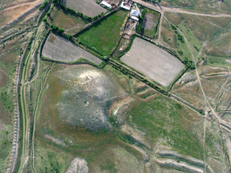
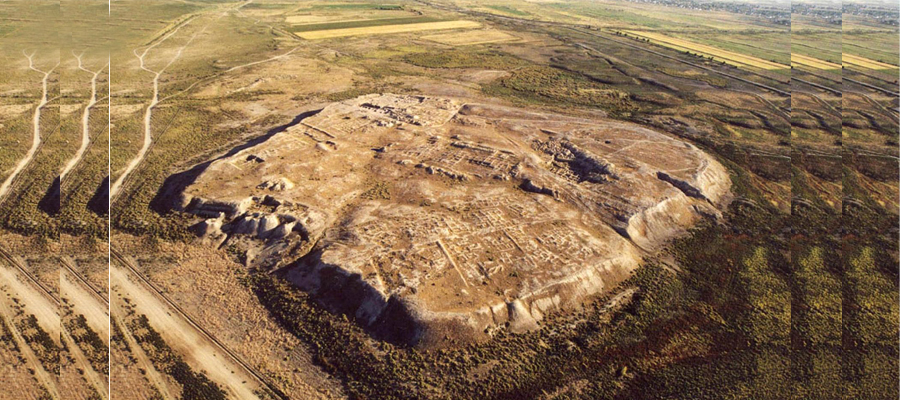
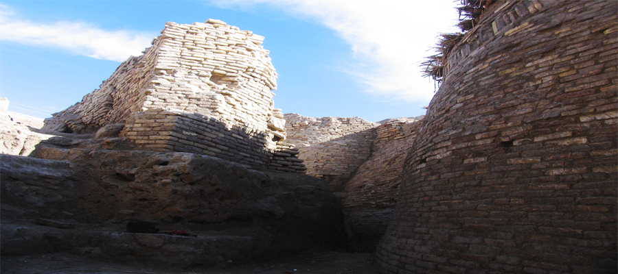
The monument is located 1 km south – west from Kogam village. Geographical coordinates are 42Т 442718 UTM 4740913. The monument was observed in 1947 by the South Kazakhstan archaeological expedition (A.N.Bernshtam). In 1949 it was excavated the eastern edge of the lower flatland. Three layers were excavated which concerns to the 6th – 10th centuries. In 1969 – 1970 the monument was observed by the South Kazakhstan complex archaeological expedition (K.A.Akishev) and small pits were put. The corners of town is rounded and rectangular, the mound is two layered. The size of the foothill is 138 m from the west to the east, and from the north to the south is 110 m. The western part is lower, 7,5 m in height, the size is 30 m from the west to the east, from the north to the south is 60 m. Eastern part is higher. The size is 30x30 m, the height is 11,5. There are numerous remains of structures, mounds. There are also remains of the ancient highway channel flows from the Arys River which located the south from citadel. There are remains on both side of the river. One of them is Zhartobe – diameter is around 100 m, the height is 6 m. The mound is shared into two sides by the old channel. Three layers were investigated during the excavation in 1949. The first layer is damaged. On the second layer there were the remains of the walls laid by bricks (42x43x7 — 9 см).


